Drone Construction Documentation for Commercial Jobsites
Drone construction documentation gives the project record aerial context.
Synced Frames includes aerial photography and aerial video where safe and legal inside the Monthly Construction Documentation Package. The aerial layer helps owners, lenders, investors, executives, and project teams understand site scale, staging, access, logistics, roof progress, exterior conditions, and visible change.
Drone coverage works best when it connects to ground photography, ground video, milestone coverage, and organized delivery from the same scheduled documentation visit.
For finished or near-finished built work, aerial coverage can also support the Completion Documentation Pass when the final record needs site context, exterior views, marketing assets, leasing visuals, or portfolio-ready selects.
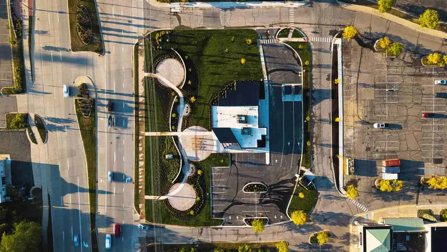
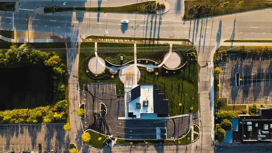
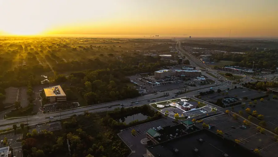
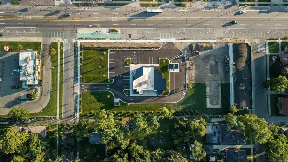
See What Aerial Documentation Looks Like
A drone documentation deliverable should make the jobsite easier to understand in 30 seconds.
What Is Drone Construction Documentation?
Drone construction documentation is aerial photo and video coverage planned around the needs of a commercial construction project.
It shows what ground photos cannot always show in one frame: site scale, building placement, roof progress, exterior elevations, access points, truck courts, laydown areas, staging, utilities, parking, surrounding context, and visible changes from one visit to the next.
For commercial teams, the value is not the drone. The value is the record.
A useful aerial construction record is properly scoped, legally flown, repeatable when needed, labeled clearly, and delivered in a way the team can use for owner updates, investor updates, lender draw conversations, OAC meeting visuals, project archives, and closeout records.
For full monthly reporting rhythm, see Monthly Construction Documentation. For close-up interior and exterior views from the ground, see Construction Progress Photography.
Why Project Teams Use Aerial Documentation
Built for site scale, logistics, roof progress, and remote review
Ground photos are still necessary. They show corridors, rooms, exterior details, facade work, installed conditions, and buildout progress up close.
Drone construction documentation adds the wider site view.
That matters when the owner is in Austin, the lender is reviewing a draw package from Dallas, or the executive team needs to understand a 40-acre Fort Worth industrial site before a Friday meeting.
Use drone construction documentation when you need:
- Site-wide progress updates
- Aerial construction documentation by date
- Drone construction photography for reports
- Roof and envelope progress
- Exterior elevation tracking
- Staging and laydown area visibility
- Access road and truck court context
- Parking, utilities, and site work visibility
- Multi-building progress views
- Owner and investor updates
- Remote executive review
- Aerial context for monthly reports
- Construction project archive assets from groundbreaking to closeout
The best use of aerial work is simple: help people who are not standing on the jobsite understand what changed, what is in progress, and how the site is moving.
Who This Is For
Commercial teams that need more than a drone flight
This service is built for construction teams that need aerial documentation tied to a project record.
It is a strong fit for:
- Developers and owners
- General contractors
- Owner's reps
- Architects and design teams
- Industrial builders
- Commercial real estate teams
- Construction marketing teams
- Business development teams
- Multi-site project teams
- Executives managing projects across Texas or multiple regions
If the project only needs a one-time aerial view, a basic drone operator may be enough.
But if the project needs repeatable documentation, construction-aware flight planning, reporting-ready files, and organized delivery, the aerial work should be treated like part of the construction documentation system from day one.
What We Capture
Site scale, staging, access, roof conditions, and visible progress
Each flight is scoped around the project phase, site access, airspace, safety rules, reporting deadline, and the questions your deliverable needs to answer.
Typical drone construction documentation may include:
- FAA Part 107 aerial photography
- Mapped, repeatable flight paths
- Same-angle aerial progress views
- Site-wide context photos
- Roof progress documentation
- Envelope and facade progress
- Exterior elevation views
- Access roads and entry points
- Truck courts, parking, and circulation areas
- Staging, laydown, and logistics zones
- Utilities and visible site work
- Multi-building site coverage
- Phased development progress
- Optional short aerial video clips
- Airspace checks and LAANC authorization when needed
The goal is not to fly every possible angle. The goal is to capture the views that make the project easier to explain.
For some jobs, that may be 12 strong aerial stills. For a 2-acre Frisco medical office project, it may mean roof, facade, access, and parking progress. For a 40-acre industrial site near Fort Worth, it may mean a larger set organized by building, phase, elevation, truck court, and reporting need.
For critical stages before work is covered, see Milestone & Pre-Cover-Up Documentation.
What You Get
Aerial files ready for reports, decks, and project records
A drone deliverable should be useful the same week it is captured. Nobody wants to sort through unnamed files the night before an owner meeting.
Depending on scope, drone documentation can include:
- Edited aerial progress photos
- Drone progress photos sized for decks and reports
- Repeatable monthly vantage points
- Optional short aerial video clips
- Dated folders organized by visit
- Files grouped by building, project area, or phase
- Exports for PowerPoint, PDF reports, Procore, SharePoint, Box, or Google Drive
- Optional one-page PDF progress summary
- Optional integration with Monthly Construction Documentation
- Delivery in 48 to 72 hours after capture, depending on scope and project requirements
The aerial record can support owner updates, investor updates, lender draw conversations, OAC meetings, executive summaries, project archives, and closeout packages.
For completed projects that need final marketing assets, see Completion / Final Build Photography. Drone documentation and final build photography are different tools. One tracks the job as it moves. The other presents the finished project after construction is complete.
See a Sample Monthly Progress ReportHow the Process Works
1. Scope the job
We confirm the project phase, location, site access rules, reporting deadline, drone feasibility, and the questions the deliverable needs to answer.
For a Frisco medical office buildout, the priority may be exterior progress and roof conditions. For a multi-building industrial project near Fort Worth, it may be site logistics, truck courts, building pads, parking, utilities, and envelope progress.
2. Check airspace and plan the flight
We review the project location, airspace constraints, launch area, altitude needs, safety limits, site rules, and whether LAANC authorization is needed.
If repeat documentation is part of the scope, we plan the views so future visits can match the previous coverage.
3. Capture the aerial record
We coordinate with the superintendent or project contact and capture aerial assets without slowing crews.
The flight is focused on the views that matter to the team: site scale, roof progress, exterior work, access, staging, vertical progress, logistics, multi-building progress, or whatever the current reporting cycle needs.
4. Organize and deliver the files
Photos and optional video clips are edited, labeled, and delivered in 48 to 72 hours, depending on scope and project requirements.
Exports are prepared for the places your team actually uses: decks, PDF summaries, shared folders, meeting agendas, owner updates, draw packages, and project records.
Why Not Just Hire a Drone Operator?
A drone operator can capture aerial images. That does not automatically mean the project gets usable construction documentation.
The difference is planning and construction context.
A random drone visit may produce good-looking photos. But if the angles change every month, the files are not labeled, the roof condition is missed, the staging area is cropped out, or nobody checks the reporting need before flying, the images become harder to use later.
Synced Frames treats aerial work as part of the project record.
| Capability | Basic drone operator | General drone vendor | Construction camera | Synced Frames drone documentation |
|---|---|---|---|---|
| FAA Part 107 licensed flight | Sometimes | Sometimes | N/A | ✓ |
| Airspace checks | Rarely | Sometimes | N/A | ✓ |
| LAANC authorization when needed | Rarely | Sometimes | N/A | ✓ |
| Repeatable monthly flight paths | Rarely | Sometimes | Fixed view only | Yes, when scoped |
| Site scale and surrounding context | Sometimes | Sometimes | Limited | ✓ |
| Staging, access, and logistics views | Rarely | Sometimes | Limited | ✓ |
| Roof and envelope progress | Sometimes | Sometimes | Limited | ✓ |
| Files organized for reports | Rarely | Sometimes | Limited | ✓ |
| Ground and aerial documentation option | No | Rarely | No | ✓ |
| Delivery in 48 to 72 hours | Unclear | Sometimes | N/A | Yes, depending on scope |
The difference is not the drone. It is whether the flight is planned around commercial construction, stakeholder use, repeatable documentation, and the larger project record.
Common Use Cases
Site-wide progress updates
Show building placement, exterior progress, site work, access roads, staging, parking, utilities, and surrounding context in one clear aerial view.
Roof and envelope progress
Document roof work, parapets, rooftop equipment areas, facade progress, exterior elevations, and envelope milestones that are hard to explain from ground level.
Owner and investor updates
Give owners, investors, asset managers, and executives a clear view of progress without relying on phone photos or verbal updates.
Lender draw support
Add aerial context to draw conversations when site progress, exterior status, roof conditions, or phased development needs to be easy to review.
Multi-building commercial sites
Use aerial documentation for industrial parks, retail pads, mixed-use developments, campus-style projects, and commercial sites with multiple active zones.
Monthly documentation retainers
Add drone coverage to Monthly Construction Documentation so each reporting cycle includes both ground progress photography and aerial site context.
Closeout and portfolio records
Capture final aerial views as part of the closeout archive, then move into Completion / Final Build Photography when the project is ready for finished project assets.
Scope and Pricing Guidance
Scoped per project based on airspace, site size, cadence, and deliverables
Drone construction documentation is scoped around the job. It is not priced like a quick photo flight.
Pricing depends on:
- Site location
- Controlled airspace or LAANC needs
- Site size
- Flight frequency
- Number of buildings or project areas
- Rooftop, envelope, or exterior requirements
- Staging and logistics coverage needs
- Ground photography add-ons
- Optional aerial video clips
- Reporting deadline
- Whether coverage is one-time, monthly, or part of a larger retainer
A 2-acre Frisco commercial project, a 12-acre Dallas site, and a 40-acre Fort Worth industrial development do not need the same flight plan.
The cleaner way to scope it is to look at the location, airspace, access, cadence, reporting need, and deliverables your team actually needs.
Send Your Project PhaseFAQ
Are you FAA Part 107 licensed?
Yes. Synced Frames provides FAA Part 107 drone construction documentation for commercial projects where drone flight is allowed by airspace, site rules, safety conditions, and weather.
Can you fly near airports?
Often, yes. It depends on the site location, controlled airspace, altitude limits, safety conditions, and authorization requirements. We check airspace before the flight and request LAANC authorization when needed.
Do you provide the same angle each month?
Yes, when repeat coverage is part of the scope. We can map repeatable flight paths and capture consistent aerial views so monthly site progress is easier to compare.
What happens if drone flight is not allowed?
If drone flight is not allowed because of airspace, site restrictions, safety concerns, weather, or project rules, we can provide ground-based alternatives, elevated viewpoints when available, or reschedule when conditions allow.
Can drone coverage be combined with ground photography?
Yes. Drone documentation can be combined with Construction Progress Photography, Monthly Construction Documentation, Milestone & Pre-Cover-Up Documentation, or Completion / Final Build Photography.
How fast are the files delivered?
Most edited aerial stills and short clips are delivered in 48 to 72 hours, depending on scope. Larger project scopes, multi-site coverage, or custom PDF summaries may need a different delivery window.
Related Services
For recurring site visits that combine ground photos, drone views, milestone coverage, and organized monthly delivery.
View Service
Construction Progress PhotographyFor ground-level progress photos, interior buildout, exterior status, facade progress, and same-angle jobsite photography.
View Service
Milestone & Pre-Cover-Up DocumentationFor stage-specific documentation before work is covered or conditions change.
View Service
Completion / Final Build PhotographyFor finished project photography and video after construction is complete, including closeout, portfolio, leasing, award, and proposal use.
View Service
Need aerial context inside a usable project record?
If the project is active, send the phase. If the work is finished or near-finished, send the completion scope.